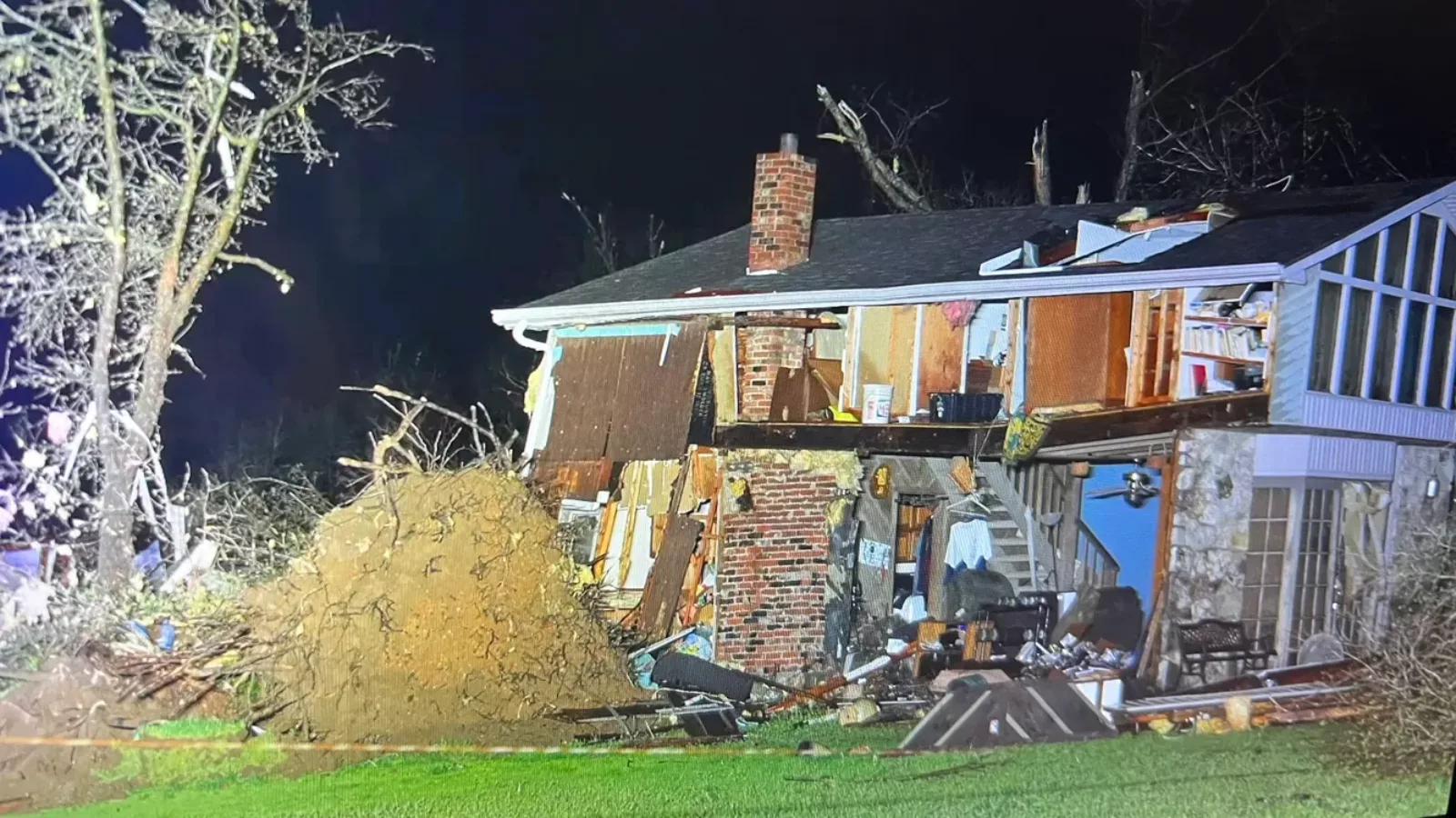
Following a weekend of severe thunderstorms that wreaked havoc across the Midwest, towns in southern Missouri were again rocked by a new series of supercell thunderstorms that would produce tornadoes and hail. The peak of the storms came late Tuesday night as multiple EF-2 and EF-3 strength twisters were spotted in the area. Local correspondents are currently assessing the scope of the destruction caused by the storms. Still, early reports already state there are multiple deceased and injured and millions of dollars in damages thus far. As the supercell continues to move eastward, meteorologists warn those closer to the coast to prepare for similar storms landing near them within the week.
FOX WEATHER: Tornado Watches span 900 miles from Great Lakes to mid-South after deadly twister hits Missouri
By Andrew Welfeck, Brian Donegan & Scott Sistek; April 5, 2023
GLENALLEN, Mo. – At least five people have died, and several others were injured as a severe weather outbreak that produced tornadoes and large hail across the Midwest on Tuesday turned fatal as it continued its trek eastward Wednesday after a strong tornado struck a town in southeastern Missouri.
Supercell thunderstorms tore across parts of north-central and northeastern Arkansas early Wednesday morning, prompting the National Weather Service to issue Particularly Dangerous Situation (PDS) Tornado Warnings. The supercells then crossed into southeastern Missouri, prompting additional PDS Tornado Warnings for some towns in Oregon, Bollinger and Cape Girardeau counties, including Myrtle, Marble Hill, Glenallen and Oak Ridge.
Glenallen, Missouri, took a direct hit from what Doppler radar indicated was likely a tornado of EF-2 or EF-3 strength at about 3:45 a.m. CDT, according to NOAA’s Storm Prediction Center.
At least five people have been killed and multiple others were injured, according to a Facebook post from Bollinger County Sheriff Casey Graham.
“There is large debris and trees and such blocking multiple roadways, and it’s still dark,” Parrott told FOX Weather. “So we’re having a hard time getting around the county to assess the (tornado), but at this point, we are in full mode search and rescue.”
Storm chaser Brandon Clement with Live Storms Media told FOX Weather he witnessed several homes destroyed and some people being treated for injuries by first responders.
“The whole area has a lot of trees down, power lines down, a lot of roofs off, a lot of trailers destroyed, so it’s a pretty rough area,” Clement said.
Missouri Gov. Mike Parson said he would be touring the destruction after the deadly tornado ripped through parts of the state, including Glenallen. He added that his previous executive order, which was issued on March 31 activating the Missouri State Emergency Plan and the Missouri National Guard, would remain in effect.
Tracking storms now
The FOX Forecast Center is continuing to track multiple rounds of storms Wednesday, impacting communities from the Great Lakes and Ohio Valley down to the mid-South.
“There are a lot of folks from the lower Great Lakes all the way down to almost the Gulf Coast that need to be aware of this severe weather threat,” FOX Weather meteorologist Ian Oliver said.
Threats from the storms will likely involve damaging wind gusts, large hail and a few tornadoes.
Wednesday’s severe weather threat zone
Storms will continue to trek eastward on Wednesday, with the most significant threat of severe weather expected to be over the Great Lakes, Ohio Valley and mid-South, shaded in the darkest red on the map below.
The FOX Forecast Center is paying close attention to those regions, where atmospheric ingredients could be in place to promote additional thunderstorm development through the afternoon and evening.
Damaging wind gusts, large hail and a few tornadoes are expected with Wednesday’s round of storms.
“As you start seeing some of that daytime heating destabilizing the atmosphere, this is going to be an atmosphere that can once again support strong and severe thunderstorms,” Oliver said.
Detroit, Indianapolis, Columbus in Ohio and Memphis and Nashville in Tennessee are among the cities included in Wednesday’s risk of severe weather.
Strong to severe storms possible in mid-Atlantic on Thursday
As the cold front moves through the Eastern Seaboard, the chance for strong to severe storms will linger on Thursday from around Philadelphia southward to North Carolina, including interstates 95 and 81.
The FOX Forecast Center said if enough deep moisture is in place, some areas that experienced severe weather last weekend could be at risk again for hail, damaging winds and even an isolated tornado.
Cities in Thursday’s possible storm zone include Philadelphia, Baltimore, Washington and Richmond in Virginia.
Strong to severe storms will also be possible over Deep South Texas, but the primary threat is expected to be large hail.
Photo:
